Accurate population estimates are critical in many fields of study, including emergency management, healthcare,
crime, planning, and environmental monitoring. The Census is a common data source yet it presents population as evenly
distributed across areas, even in lakes, streams, and highways.

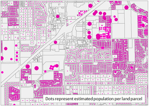
Dasymetric population techniques present a more realistic view of population distribution by combining census data with additional information such as night-time lights, land cover, address points, electricy hookups, and property tax information. Dasymetric methods date from the 1980s and have undergone rigorous testing and are unquestionably considered more accurate than non-dasymetric estimation methods.
The high resolution and level of detail in cadastral (taxlot) data make it well-suited for dasymetric estimations. Each individual property record contains information collected by the county property appraiser that can help predict the degree of habitation on the property.
We adapt Maantay's (2007) urban formula to accomodate challenges in Florida's landscape such as large land tracts, group living, and rurality. Our method performs over one billion calculations resulting in an estimated population for each of Florida's 9 million property parcels.
For more information, see usng-gis.org/population.html